This year, the unease is arriving ahead of schedule. High above the Arctic, in a layer of the atmosphere most of us never think about, the polar vortex is already misbehaving — and it’s doing so in a way that’s making veteran scientists pause, scroll back through old datasets, and mutter things like, “That shouldn’t be happening yet.”
In late December, while airports buzz with holiday traffic and thermostats quietly click up a notch, the stratosphere is staging a drama that usually waits until the heart of winter. Winds tens of kilometers overhead are slowing, bending, and wobbling under pressure from powerful atmospheric waves. On the ground, everything looks normal. In the data, it very much isn’t.
Something is stirring earlier than expected.
The polar vortex typically forms a tight, circular ring over the Arctic during winter. This year, it’s already showing signs of distortion.
The sky is twisting sooner than it should
In forecasting centers from Berlin to Washington, December has taken on a different tone. Instead of the usual quiet monitoring phase, meteorologists are already dissecting stratospheric charts that look more like mid-January. Model runs show the polar vortex — that vast whirlpool of cold air spinning above the North Pole — stretching, tilting, and losing its neat circular shape weeks ahead of schedule.
At roughly 30 kilometers up, wind speeds that should be roaring are suddenly sagging. Warm air pulses from the lower atmosphere are punching upward, denting the vortex like repeated blows to a spinning top. Several researchers have described the pattern as unusually aggressive for December, with pressure anomalies reaching levels more typical of peak winter events.
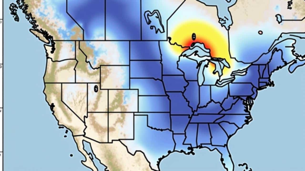
Historically, the vortex forms in autumn, strengthens through November, and only becomes fragile in January or February, when sudden stratospheric warming (SSW) events sometimes crack it open. According to data from the European Centre for Medium-Range Weather Forecasts (ECMWF) and analyses shared by the UK Met Office, this year’s disruption is arriving out of sequence, driven by intense wave activity propagating northward.
That timing matters.
Why scientists are uneasy about this December shift
This isn’t a full collapse of the polar vortex — not yet. But the intensity of the disturbance is what’s setting off alarm bells. Some model scenarios show the vortex splitting into two lobes. Others show it slumping off the pole toward Siberia, weakening its grip on Arctic air. A few suggest it could recover after taking a hit. All agree on one point: this is not a routine December wobble.
In major past events — like 2013 in North America or Europe’s 2018 “Beast from the East” — vortex disruptions occurred deeper into winter. Snow cover was established, solar input was minimal, and the atmosphere was primed for cold air to spill south. This time, the shove is coming earlier, when the seasonal setup is different and the downstream effects harder to pin down.
Researchers at NOAA’s Climate Prediction Center note that early-season stratospheric disturbances don’t guarantee extreme weather, but they do tilt the odds. When the vortex weakens, the jet stream often becomes more meandering, allowing Arctic air to escape its usual confines.
And once that door cracks open, it doesn’t always close neatly. Sudden stratospheric warming events can raise upper-atmosphere temperatures by 30–40°C in a matter of days.
What a disturbed polar vortex actually means on the ground
For people outside the meteorology bubble, the polar vortex can sound abstract, even overhyped. In reality, it’s less about a single storm and more about the background “mood” of the northern atmosphere.
When the vortex is strong, cold air stays bottled up near the pole. When it weakens, the jet stream tends to kink and slow, creating blocking patterns — stubborn high-pressure systems that lock weather in place. That’s when you see prolonged cold snaps, repeated snowstorms over the same regions, or sharp temperature swings that feel out of character.
Here’s how the risks typically shift after a vortex disturbance:
| Atmospheric Change | What Happens Aloft | Possible Surface Impact |
|---|---|---|
| Weakened vortex | Slower, distorted polar winds | Arctic air more likely to move south |
| Blocking highs | Jet stream stalls or loops | Multi-day cold spells or snow |
| Vortex displacement | Cold pool shifts off the pole | Regional extremes, not uniform cold |
For North America, that can mean bitter Midwest cold while the West Coast stays mild. In Europe, a blocked Atlantic pattern can funnel icy air into central and northern regions while storms repeatedly track along the same paths.
None of this is guaranteed. But the probabilities are shifting enough that forecasters are paying close attention to 10–30-day outlooks and ensemble trends from agencies like NOAA and ECMWF.
How governments, businesses, and households are quietly adjusting
No one is calling for panic. But behind the scenes, planning is already happening.
Energy analysts are watching demand curves, aware that sudden cold snaps can stress grids already under winter load. Airlines and transport operators are scanning for signs of persistent blocking patterns that can disrupt hubs for days at a time. Municipal planners are reviewing salt stocks and staffing rosters earlier than usual.
For households, the response doesn’t need to be dramatic. It’s about resilience, not fear.
- A few practical steps that actually matter:
- Check backup heating systems and insulation during calm weather.
- Keep a modest buffer of food and essentials in case travel is disrupted.
- Have a plan to check on elderly neighbors or relatives during cold spells.
- Rely on forecasts from established agencies, not viral social-media maps.
As the U.S. National Weather Service regularly reminds the public, long-range signals indicate risk, not destiny. A disturbed vortex raises the chances of extremes; it doesn’t script exact outcomes.
The bigger climate question hanging over this winter
There’s an uncomfortable undercurrent to all of this. Scientists are still debating how a warming climate influences the polar vortex, but the conversation has shifted noticeably over the last decade.
Some studies suggest that reduced Arctic sea ice and warmer autumn oceans allow more heat and moisture into the lower atmosphere, amplifying the planetary waves that later batter the stratosphere. Others argue the relationship is complex, mediated by factors like the Quasi-Biennial Oscillation (QBO) and El Niño–Southern Oscillation (ENSO). NASA and NOAA researchers continue to explore these links using long-term satellite data.
What’s hard to ignore is the pattern: high-impact vortex events are showing up more often in public memory. They’re no longer once-in-a-generation anomalies. They’re becoming part of the risk landscape.
For policymakers, that means infrastructure designed around historical averages may be increasingly mismatched to reality. For individuals, it’s more personal — the decision to upgrade a winter coat, rethink travel timing, or take cold warnings a bit more seriously than before.
FAQs
Q. What is the polar vortex in simple terms?
It’s a large area of low pressure and cold air that circles the Arctic during winter, helping keep frigid air contained.
Q. Does a disturbed polar vortex mean extreme cold is guaranteed?
No. It increases the risk of cold outbreaks, but outcomes vary by region and timing.
Q. How soon could effects be felt on the ground?
Typically 1–3 weeks after a major stratospheric disturbance, though impacts can be uneven.
Q. Is this linked to climate change?
Scientists are studying possible links, but the relationship is complex and still debated.
Q. Where should I follow reliable updates?
Agencies like NOAA, the UK Met Office, and national weather services provide vetted analysis.